|
Lower
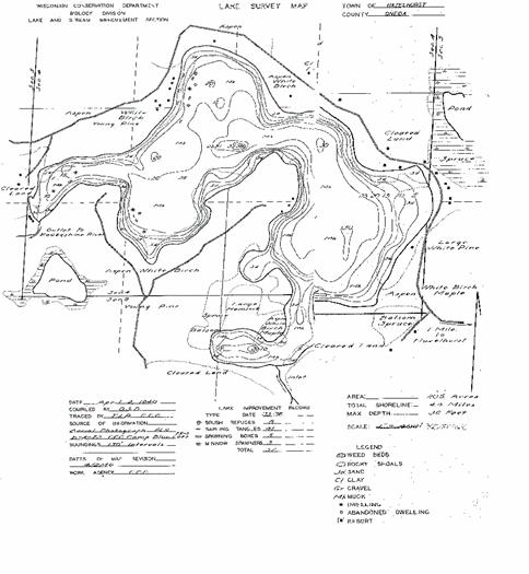
Kaubashine Lake is a small lake and as a result you won’t find a current lake
map available in the stores. This survey map was created in 1840! It lists
some of the lake statistics as follows: - total lake acreage as 205 -4.4 miles of shoreline -maximum depth of 36 feet. |
|
Lower Kaubashine Lake is a “Class A”
Musky lake. Northern pike, crappie, perch, as well as large mouth and small
mouth bass abound. So if you are
looking for a nice fishing lake. You should be pleasantly surprised with this
one. The lake’s size is an advantage when working to find the fish depending
upon the season and weather conditions. |

|
Lake Survey
Map |
|
Email: kaubashine@direcway.com |
|
Lake Cam Location |